Here’s the challenge from Twitter:
The battle over the precise location of the Brunswick Bar rages: flickr.com/photos/jmv/767…changingvancouver.wordpress.com/2013/12/13/the…
And here’s how the precise location was determined… My thanks to Andy Coupland for the map work.
- Determine what is around your site where the location is confirmed.
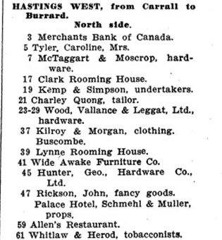
- 23-29 – Wood Vallance Leggat; known location http://changingvancouver.wordpress.com/2012/12/18/wood-vallance-and-leggat-west-hastings-street/ built c1899.
- 1907 Directory says Palace Hotel built by then at 47 W Hastings.http://changingvancouver.wordpress.com/2013/10/20/palace-hotel-chelsea-inn/
 The 1912 Fire insurance map shows us where the Palace Hotel is and Wood Vallance Leggat (lot 15). The 1889 fire insurance map clearly shows the location of the Brunswick. Cut out, rotated and placed on the 1912 map, it falls squarely on lot 14 – which becomes Buscome’s and later A & N.

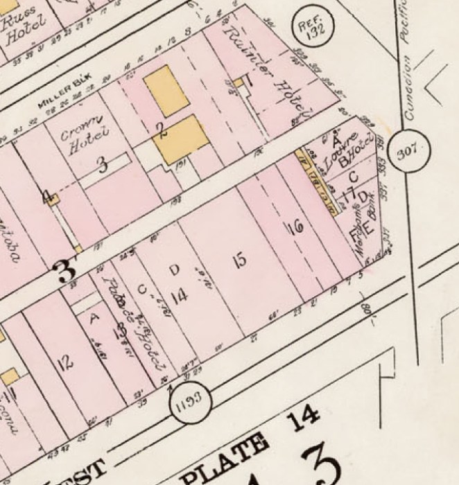
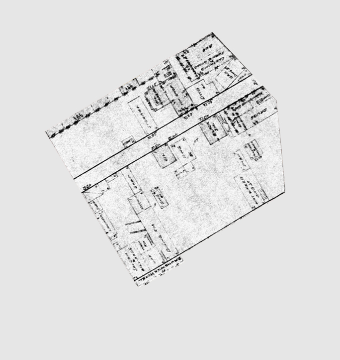
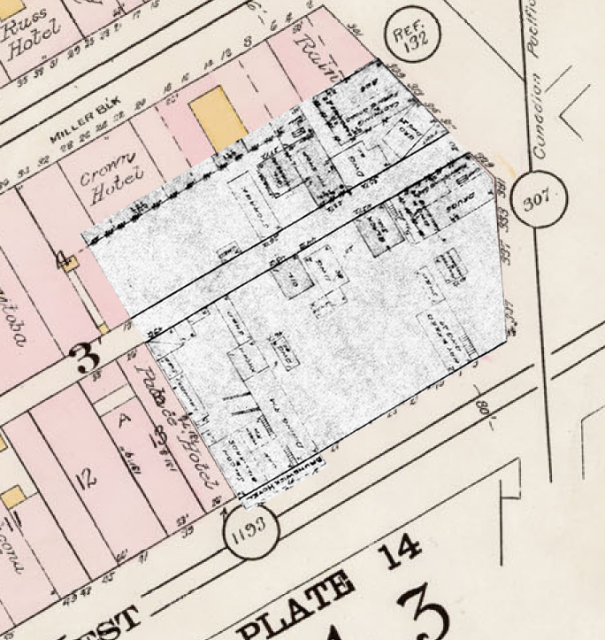
So we have determined that the Brunswick was on lot 14.
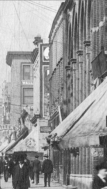
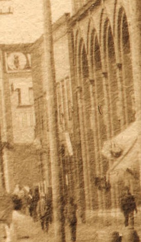
Looking in the background of a few photos we can see the Brunswick before its demolition butted up against the edge of the Wood Vallance Leggat building.